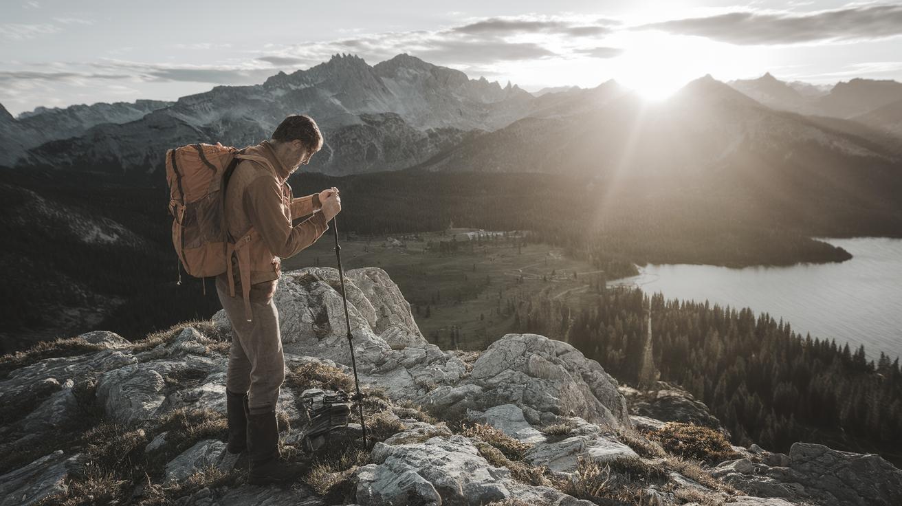
How to Tell Direction Without a Compass
Mastering compass-free navigation transforms outdoor adventures into confident wilderness exploration. These proven techniques combine traditional wayfinding methods with modern digital tools for reliable backcountry orientation.
Start with the Big Picture on the Map
Before venturing into unknown terrain, it’s essential to familiarize yourself with the area’s topographic map. Understanding the landscape’s general layout can help you anticipate and identify major features such as rivers, mountain ranges, or human-made structures.
This broader view will serve as your initial framework, helping you visualize the terrain and navigate effectively even when detailed cues are missing. Terrain association becomes your primary navigation strategy when compass readings aren’t available.
Focusing on key landmarks and their relative positions will provide reference points during your journey. It’s like creating a mental image of where you will be traveling. This preparation phase is where you establish the context for using additional natural navigation techniques.
Knowing how to read contour lines can also help you predict elevation changes and potential obstacles, enhancing your overall navigation strategy. Professional wilderness guides recommend spending at least 15 minutes studying terrain features before departure.
Zoom In on the Map to Identify Handrails
Once you’ve grasped the big picture, the next step is to zoom in on specific map details that function as natural handrails. Handrails are linear features like trails, rivers, or ridges that can guide your route and prevent dangerous navigation errors.
Identifying these features on the map and in real life helps maintain your intended course and manage progress throughout the journey. Linear navigation aids include power lines, fence lines, and geological formations that extend across your travel area.
These natural handrails can also be incredibly reassuring under conditions of poor visibility – like fog or dense forest cover – acting as reliable guides that prevent you from straying off course. By thoroughly planning and leveraging such features, you ensure a smoother and more controlled navigation experience.
Types of Effective Handrails
Primary handrails include major rivers, mountain ridges, and established trail systems. Secondary handrails encompass smaller streams, game trails, and distinct vegetation boundaries that provide supplementary directional guidance.
Expert navigators identify multiple handrail options to create redundant safety systems. This approach ensures alternative routes remain available if primary navigation features become obscured or impassable.
Let Water Be Your Guide in Backcountry Navigation
Water bodies can serve as excellent navigational aids in the wilderness. Rivers, streams, lakes, and even waterfalls provide clear directional cues and reliable reference points for position confirmation.
For instance, rivers generally flow downhill toward larger water bodies, so identifying the flow direction can help determine your relative location and direction. Watershed navigation allows experienced hikers to predict water flow patterns and terrain characteristics.
Moreover, water bodies are frequently situated near trails or other human-made pathways, making them practical reference points during navigation. Understanding the natural hydrology of your map area can also help predict the presence of water sources.
This knowledge provides crucial context in deciding the direction and scale of your travel. Stream confluence points serve as particularly reliable landmarks that remain consistent across seasons and weather conditions.
Reading Water Flow Patterns
Downstream navigation typically leads toward civilization, roads, or larger water bodies. Upstream travel generally leads toward higher elevations, water sources, and more remote wilderness areas.
Professional search and rescue teams utilize water flow direction as a primary navigation strategy when other methods fail. This technique proves especially valuable during emergency situations or when visibility becomes severely limited.
Use Treeline to Pinpoint Your Elevation
The treeline elevation, which delineates the altitude above which trees cannot grow, varies depending on geographic location and can be a useful indicator of elevation. Recognizing changes in vegetation types as you ascend or descend can assist in estimating your elevation relative to map readings.
In some regions, hiking above the treeline may expose more open terrain, enhancing visibility of distant landmarks and aiding navigation. By correlating visible vegetation zones with those marked on the map, you can confirm your position and adjust your course as necessary.
Alpine treeline typically occurs between 10,000-12,000 feet in temperate regions, though this varies significantly based on latitude and local climate conditions. Understanding these patterns helps estimate elevation without altimeter readings.
Vegetation Zone Navigation
Deciduous forests typically indicate lower elevations and moderate climates. Coniferous forests suggest higher elevations or northern exposures with cooler temperatures and different moisture patterns.
Krummholz formations (stunted, wind-shaped trees) indicate approaching treeline conditions. These distinctive growth patterns provide clear elevation markers visible from considerable distances.
Navigate with the Sun for Direction of Travel
The sun offers another ancient method of determining direction through solar navigation. By tracking its path across the sky, you can ascertain approximate east-west lines, especially useful during sunrise and sunset when directional accuracy peaks.
This celestial navigation can support realigning your travel direction when other cues are unavailable. The sun rises in the east and sets in the west, providing consistent directional reference points throughout daylight hours.
Solar positioning varies seasonally, with the sun tracking further south during winter months and further north during summer in the Northern Hemisphere. Understanding these patterns improves navigation accuracy across different seasons.
Use Shadows For Clues on Cloudy Days
Even on cloudy days, shadows – however faint – can reveal direction through shadow stick navigation. By observing the length and angle of shadows cast by objects like trees or rocks, it is possible to infer the position of the sun.
This indirect method serves as a backup to determine directions when direct sunlight isn’t available. Diffused light navigation requires careful observation but provides reliable directional information even under overcast conditions.
The shadow tip method involves marking shadow endpoints at 15-minute intervals to determine east-west direction. This technique works effectively even with minimal shadow visibility during cloudy weather.
Advanced Solar Navigation Techniques
Analog watch navigation uses traditional timepieces to determine approximate direction. Point the hour hand toward the sun, and south lies halfway between the hour hand and 12 o’clock position.
Solar noon determination identifies true south when shadows reach their shortest length. This occurs when the sun reaches its highest daily position, providing the most accurate solar directional reference.
Use the Stars to Navigate North and South
Stars have long been vital astronomical navigation aids, particularly at night when other directional cues become unavailable. By locating significant constellations, you can orient yourself naturally using time-tested celestial methods.
In the Northern Hemisphere, the North Star, or Polaris, is a reliable indicator of true north with accuracy within one degree. This stellar navigation technique has guided travelers for thousands of years across diverse terrains and conditions.
Stellar navigation requires clear skies and basic constellation knowledge but provides extremely reliable directional information. Professional astronomers confirm Polaris maintains consistent positioning relative to Earth’s rotational axis.
How to Find the North Star
To locate Polaris, identify the Big Dipper constellation; draw a line through its “pointer” stars, and it will approximately lead to the North Star. This asterism navigation method works consistently throughout the year as constellation positions rotate.
Knowing how to locate this crucial point helps maintain directional awareness throughout the night. The Big Dipper pointer stars (Dubhe and Merak) create a line extending approximately five times their separation distance to reach Polaris.
Cassiopeia constellation provides an alternative method for locating Polaris when the Big Dipper sits low on the horizon. This W-shaped constellation points toward the North Star from the opposite side of the celestial pole.
In the Southern Hemisphere, Use the Southern Cross to Navigate
In the Southern Hemisphere, the Southern Cross constellation serves a similar purpose for celestial navigation. By tracing a line along the long axis of the cross constellation, you can determine the general direction of south.
This method provides a celestial compass essential for nighttime navigation below the equator. The Southern Cross technique requires identifying the Coal Sack Nebula and pointer stars for accurate directional determination.
Crux constellation navigation involves extending the long axis of the Southern Cross approximately 4.5 times its length toward the horizon to locate celestial south. This technique maintains accuracy across Southern Hemisphere locations.
Navigate with the Prevailing Wind
Understanding prevailing wind patterns is another method to ascertain direction, particularly in open landscapes where other navigational cues may be limited. In many areas, winds are dominated by specific directions owing to regional weather patterns.
These consistent wind direction indicators can be utilized as a guide when other cues are minimal. Meteorological navigation requires understanding local weather patterns and seasonal wind variations for optimal accuracy.
By observing changes in vegetation, such as wind-swept trees or snowdrifts, you can also infer the direction of consistent winds. Supplementing other navigational tactics with wind awareness can reinforce your sense of orientation in the wild.
Flag trees and krummholz formations indicate prevailing wind direction through their distinctive growth patterns. These natural wind indicators remain visible year-round and provide consistent directional reference points.
Reading Wind Indicators in Nature
Snow drift patterns reveal prevailing wind direction, with drifts typically forming on the leeward side of obstacles. Sand dune formations in desert environments follow similar patterns, indicating consistent wind flow directions.
Vegetation lean and branch asymmetry develop over years of consistent wind exposure. These permanent natural indicators provide reliable directional information even during calm weather conditions.
Find North and South with Moss
A classic technique involves observing moss growth patterns, which tends to grow more abundantly on the north side of trees in the Northern Hemisphere. This growth pattern is due to the northern side receiving less direct sunlight, hence retaining more moisture.
Although not always perfectly aligned, it provides an additional clue towards determining your north-south orientation, especially useful in forested areas. It’s always important to corroborate such observations with additional methods to ensure accuracy.
Bryophyte navigation (using mosses and lichens) works best in consistently moist environments where growth patterns remain stable. This technique proves most reliable in temperate forests with consistent moisture and shade patterns.
Modern wilderness experts recommend using moss growth as a supplementary navigation aid rather than a primary directional method. Environmental factors like local moisture, wind patterns, and terrain features can influence moss distribution.
Understanding Moss Growth Science
Phototropism and moisture retention drive moss growth patterns on tree trunks and rock surfaces. North-facing surfaces in the Northern Hemisphere typically receive less direct sunlight, creating optimal moss growing conditions.
Lichen distribution follows similar patterns but may be more reliable than moss in certain climates. These organisms provide consistent biological indicators of directional orientation across diverse forest environments.
Pay Attention To Your Surroundings
Keen observational skills can significantly aid navigation through enhanced environmental awareness. By staying attuned to your environment, noting distinctive rock formations, changes in vegetation, and potential animal trails, you create a comprehensive mental map.
This heightened situational awareness is invaluable, ensuring you can retrace steps if needed and adapt to new information as you progress. Building a comprehensive understanding of your environment transforms potential hazards into navigational aids.
Micro-navigation techniques involve recognizing subtle environmental changes that indicate direction, elevation, or proximity to specific features. Professional trackers develop these skills through consistent practice and careful observation.
Environmental Cue Recognition
Animal trail patterns often lead to water sources, feeding areas, or shelter locations. Game trails frequently follow efficient routes through terrain, providing natural pathways for human navigation.
Rock formation analysis reveals geological processes that indicate slope direction, water flow, and terrain stability. Understanding these patterns enhances both navigation accuracy and travel safety.
Soil color variations and vegetation health differences indicate moisture levels, sun exposure, and elevation changes. These subtle environmental indicators provide valuable navigation information to trained observers.
Modern Digital Navigation Tools
GPS technology integration enhances traditional navigation methods without replacing fundamental wilderness skills. Modern outdoor enthusiasts combine time-tested techniques with digital tools for comprehensive navigation strategies.
Smartphone navigation apps provide backup systems when primary navigation methods become challenging. However, battery limitations and signal availability require maintaining traditional navigation competencies.
Watch this 8-minute Tutorial to Learn How to Create a Route in Gaia GPS
For a more modern approach to navigation, digital mapping tools offer valuable resources that complement traditional wayfinding methods. An 8-minute tutorial on creating routes in Gaia GPS demonstrates how to leverage technology alongside traditional methods.
This integration fully enhances your navigational toolkit by combining proven wilderness techniques with modern GPS accuracy. Route planning software allows pre-trip preparation that identifies potential navigation challenges and alternative pathways.
A Fond Farewell to National Geographic Maps —…
As technology advances, some classic navigation tools receive less attention in modern outdoor education. Whilst bidding farewell to physical National Geographic maps might seem bittersweet, it marks a transition to more dynamic mapping solutions.
However, paper map literacy remains essential for wilderness navigation when digital devices fail. The combination of traditional cartographic skills with modern technology creates the most reliable navigation system.
Introducing the Gaia Hike Map: Your Trail-Ready Adventure…
The Gaia Hike Map introduces tailored features for outdoor enthusiasts seeking comprehensive navigation solutions. With topographic and satellite layers, it combines precision with ease of use, offering a comprehensive view of trails and terrain.
This specialized mapping platform provides detailed trail information, elevation profiles, and waypoint marking capabilities. The integration of multiple map layers enhances navigation accuracy across diverse terrain types.
Download the app and get a free 14-day…
By downloading the app, you gain access to a free 14-day trial, providing opportunities to explore its features and capabilities. This trial period allows comprehensive testing of navigation tools before committing to subscription services.
The trial includes access to premium mapping layers, offline download capabilities, and advanced route planning features. This comprehensive access enables thorough evaluation of digital navigation tools.
Gaia GPS is Improving Satellite Imagery: Saying Goodbye…
As Gaia GPS enhances its satellite imagery, users benefit from sharper, more detailed visuals for improved terrain recognition. This improvement simplifies terrain recognition and destination planning, further solidifying its role as an indispensable navigation tool.
Enhanced satellite resolution provides clearer identification of terrain features, vegetation boundaries, and human-made structures. These improvements bridge the gap between digital mapping and real-world terrain recognition.
How I Used Gaia GPS to Navigate Italy
Gaia GPS navigation was instrumental during a cultural journey across Italy, seamlessly integrating scenic tours with historical explorations. Its precise tracking and real-time updates ensured successful navigation amid complex cities and countryside alike.
The platform’s international mapping capabilities provide reliable navigation across diverse geographic regions. This global functionality makes it valuable for both domestic and international outdoor adventures.
Emergency Navigation Strategies
Survival navigation techniques become critical when primary navigation methods fail or emergency situations develop. Understanding backup navigation strategies ensures safe wilderness travel even under adverse conditions.
Signal mirror techniques and ground-to-air signals help communicate location information to rescue teams. These emergency communication methods complement navigation skills for comprehensive wilderness safety.
Creating Improvised Navigation Tools
Stick and shadow compasses provide directional information using minimal equipment. This technique involves placing a straight stick vertically and marking shadow tip positions to determine east-west direction.
Improvised sundials help determine approximate time and direction simultaneously. Understanding these techniques ensures navigation capability even when all equipment becomes lost or damaged.
Seasonal Navigation Considerations
Winter navigation presents unique challenges including snow-covered landmarks, altered terrain features, and reduced daylight hours. Seasonal navigation adaptations ensure year-round wilderness travel safety.
Spring navigation involves dealing with snowmelt, swollen streams, and changing vegetation patterns. Understanding seasonal variations improves navigation accuracy across different times of year.
Weather Impact on Navigation
Fog navigation techniques rely heavily on sound, terrain features, and careful pace counting. Limited visibility conditions require enhanced reliance on non-visual navigation methods.
Storm navigation involves seeking shelter while maintaining directional awareness. Understanding weather pattern impacts on navigation ensures safe travel during adverse conditions.
Final Thoughts
Compass-free navigation mastery combines multiple techniques for reliable wilderness orientation. These proven methods ensure safe outdoor adventures while building confidence in natural wayfinding abilities.
Regular practice of these traditional navigation skills maintains competency levels essential for wilderness safety. The integration of modern technology with time-tested techniques creates the most comprehensive navigation approach.
| Method | Description | Accuracy Level | Best Conditions |
|---|---|---|---|
| Big Picture on the Map | Understand overall terrain features and landmarks. | High | Clear visibility, detailed maps |
| Zoom In on the Map | Identify linear handrails for detailed navigation. | Very High | Accurate topographic maps |
| Water Bodies | Use them as directional guides and trails indicators. | High | Areas with consistent water flow |
| Treeline | Utilized to pinpoint elevation. | Moderate | Mountain environments |
| Sun and Shadows | For general east-west orientation and cloudy day clues. | High | Clear or partially cloudy skies |
| Stars | Navigate by identifying constellations like North Star and Southern Cross. | Very High | Clear night skies |
| Wind Patterns | Recognize regional winds as direction indicators. | Moderate | Consistent weather patterns |
| Moss Growth | Infer north-south orientation based on growth on trees. | Low-Moderate | Moist forest environments |
| Surroundings Awareness | Utilize environmental cues for situational navigation. | Variable | All environments with practice |
| Gaia GPS | Enhance traditional methods with technological mapping. | Very High | Areas with GPS signal coverage |